Weser


Hann. Münden to the North Sea
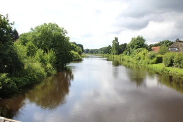
"Where Werra and Fulda kiss, you must atone for your name...", begins the inscription on a memorial stone on the Tanzwerder in Hannoversch Münden. The Weser is formed at the confluence of the Werra and Fulda rivers and begins its journey to the North Sea, where it is the only German river that does not touch any other land. The Weser, already known in Roman times as Visurgis and called Wisera or Wisura in old German, is navigable along its entire length.
The Upper Weser (from Hann. Münden to Porta Westfalica, approx. 200 km) flows with its winding course through the charming landscape of the Weserbergland, through numerous old towns worth seeing such as Bad Karlshafen, Höxter and Hameln.
The Middle Weser (approx. 150 km)
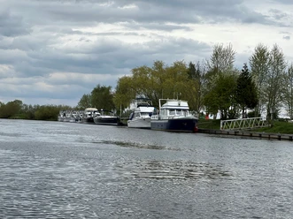
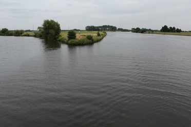
The Middle Weser begins where the Weser leaves Porta Westfalica behind and flows leisurely northwards into the expanse of the North German Plain. The area stretches from Minden to just before Bremen, where the river becomes a waterway. Places of interest include Petershagen, Stolzenau, Nienburg, Hoya, Verden and Achim.
The Lower Weser (approx. 150 km)
It runs from Bremen to the North Sea near Cuxhaven.
Barrages and weirs
To ensure that even fully loaded ships have enough "water under the keel" at any time of year, the Middle Weser is regulated by seven barrages. The gradient between the different water levels is used to generate energy in the adjacent hydroelectric power plant. This means that around 40 meters of altitude are overcome over 150 kilometers. So-called "fish ladders" allow fish to pass through the locks.
A dam consists of a weir, lock with channel, hydroelectric power station, fish ladder, canoe chute or transfer point.
There are still three ferries on the Middle Weser:
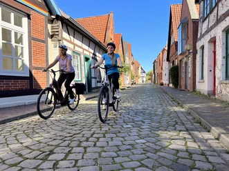
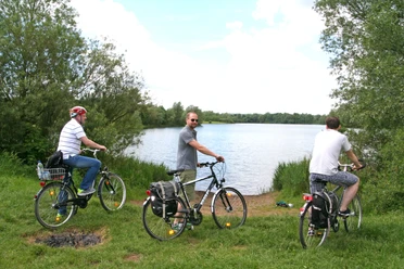
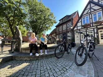
The Weser Cycle Path (515 km) from Hann. Münden to the North Sea (www.weserradweg-info.de) is well known.
"Where Werra and Fulda kiss, you must atone for your name...", begins the inscription on a memorial stone on the Tanzwerder in Hannoversch Münden. The Weser is formed at the confluence of the Werra and Fulda rivers and begins its journey to the North Sea, where it is the only German river that does not touch any other land. The Weser, already known in Roman times as Visurgis and called Wisera or Wisura in old German, is navigable along its entire length.
The Upper Weser (from Hann. Münden to Porta Westfalica, approx. 200 km) flows with its winding course through the charming landscape of the Weserbergland, through numerous old towns worth seeing such as Bad Karlshafen, Höxter and Hameln.
The Middle Weser (approx. 150 km)
The Middle Weser begins where the Weser leaves Porta Westfalica behind and flows leisurely northwards into the expanse of the North German Plain. The area stretches from Minden to just before Bremen, where the river becomes a waterway. Places of interest include Petershagen, Stolzenau, Nienburg, Hoya, Verden and Achim.
The Lower Weser (approx. 150 km)
It runs from Bremen to the North Sea near Cuxhaven.
Barrages and weirs
To ensure that even fully loaded ships have enough "water under the keel" at any time of year, the Middle Weser is regulated by seven barrages. The gradient between the different water levels is used to generate energy in the adjacent hydroelectric power plant. This means that around 40 meters of altitude are overcome over 150 kilometers. So-called "fish ladders" allow fish to pass through the locks.
A dam consists of a weir, lock with channel, hydroelectric power station, fish ladder, canoe chute or transfer point.
There are still three ferries on the Middle Weser:
- PetraSolara Windheim-Hävern (cyclists, people)
- Schweringen (cars, cyclists, people)
- Gentsiet Hagen-Grinden - Ahsen Oetzen (cyclists, people)
The Weser Cycle Path (515 km) from Hann. Münden to the North Sea (www.weserradweg-info.de) is well known.
Good to know
Author
Mittelweser-Touristik GmbH
Lange Straße 18
31582 Nienburg/Weser
Organization
Mittelweser-Touristik GmbH
License (master data)
Mittelweser-Touristik GmbH

Nearby

