Mythos Moor


- 2:14 h
- 9.20 km
- 20 m
- 15 m
- 15 m
- 33 m
- 18 m
- Destination: Parking lot cemetery, Roedenbeckstraße
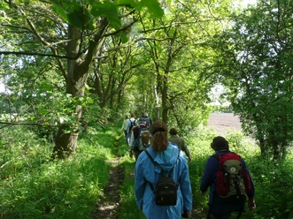
Many moorlands have been drained in recent decades due to peat extraction. The “Mythos Moor” hiking tour winds through a varied landscape, inviting you to enjoy the tranquility of the moorland and explore the Achim Golf Course.
Directions:
From the parking lot, turn left onto the unpaved path. The Lindholz (1) is on your right. At the fork in the path, keep left again (2). You are now on the direct route to the Etelser Moor (3). The trail leads straight ahead until you turn left onto “Schlackenweg.” At the next turn, turn left again and head back into the moor. Following this path, you’ll eventually reach “Roedenbeckstraße” (4) and cross it. You’ll leave the moor behind you.
Now you’ll walk through the grounds of the Achim Golf Course (5). You’ll hike along the access road to the golf clubhouse, which is lined with an avenue of oak trees. After that, you’ll come to the small Bassener Mühlengraben and turn right. Walk a short distance along the golf course, then turn left and, at the fork in the path, turn left again. Now keep to the right and follow the path to Steller Berg. Once there, turn left at the bench and cross the golf course. After about 300 m, turn left again and come to a fork in the path; take the right fork. At the next fork, turn left again. This path takes you past the Nordhornsberg grove, and then continue straight ahead at the intersection.
At the next intersection, turn left and pass the golf course once more. Cross the street “Im Rucksort” to reach “Roedenbeckstraße” again. Once you’ve crossed it, turn left and then right to return to the starting point.
Points of Interest/Interesting Facts:
(1) Lindholz:
The Lindholz is a species-rich mixed forest with spruce, English oak, European beech, and larch. The birdlife is correspondingly diverse: jackdaws, woodpeckers, tree creepers, titmice, bullfinches, robins, wrens, and many others call this place home.
(2) Sand Dunes/Swimming:
Today, with the exception of a few tiny remnants, the Achim section of the dune ridge between Bremen and Langwedel, shown here, is no longer visible. Extensive sand mining and near-total urbanization mean that the vast sandy expanses from the turn of the century can now only be imagined. Surrounded by moors and wet lowlands, the Achim Geest plateau was formed during the Ice Age as an elevated ground moraine plateau with a belt of dunes. Looking at these sand masses offers a possible explanation for the founding legend of Achim, according to which the name Achim is said to derive from the exclamation of a dying Saxon nobleman: Wounded by Charlemagne’s pursuers, he—fleeing from the direction of Verden—is said to have exclaimed upon reaching the Achim dunes, “Ah, I must die in the sand,” but only the words “Ah, in the ...” managed to escape his lips before death overtook him.
(3) Etelser Moor:
The Etelser Moor is a raised bog heavily overgrown with birch and pine trees, featuring scattered areas of heathland, and is a popular destination for migratory beekeepers. Everywhere you look, you can see traces of peat cutting from days gone by: meter-high peat walls and deep water ditches, all of which drain into the Bassener Mühlengraben. Peat was a vital raw material in the last century and was used for heating. The moor has been largely drained, but sphagnum mosses and sundews grow in some former peat pits where water still stands. You can also find cottongrass and heather here. It is a very special habitat for insects, birds, reptiles, and other animals.
In the nearby Badener Moor, an area of about eight hectares was rewetted following efforts by the Nature Conservation Union. This is intended to contribute to climate protection in the long term. Using machinery, a dam made of water-impermeable black peat was built to prevent rainwater from draining away. This project thus creates more habitat for many endangered animal and plant species.
(4) Badenermoor:
The Badenermoor district of Achim did not develop historically over the centuries like the former villages, but was artificially created as a settlement in the middle of the Badener-Etelser-Ueser Moor according to the vision of Roedenbeck, the district administrator of Achim at the time. Unfortunately, he was unable to witness the completion of his “life’s work,” as he was killed in action as a soldier in Flanders as early as November 1914. Beneath the Roedenbeck Oak, next to the memorial to District Administrator Roedenbeck, another commemorative stone was erected to honor the fate of the prisoners of war of that time. From 1914 to 1919, a fenced-in and guarded camp existed in the area, where primarily Belgian and French prisoners of war were interned. It was they who, from 1914 to 1918, had to build the first paths and ditches to make the moor accessible. They also reclaimed part of the moor and cultivated crops there—such as potatoes—to feed themselves. Once settlement was complete in the early 1920s, the moor colony was supposed to become independent and be named Roedenbeck. The Roedenbeck oak tree and the memorial stone can be found next to the cemetery at the end of the tour. Tip: Just a few meters away, in the center of the village, there is an information board from the Achim Local History Association detailing the village’s history.
(5) Achim Golf Course:
Completed in 1998, this approximately 125-hectare golf course blends harmoniously into the landscape, where ditches, ponds, bunkers, scattered groups of trees, and wooded areas come together to form a cohesive ensemble. However, the redesign also resulted in the loss of some features: These included extensively used, wet, herb-rich meadows that served as a refuge for a shy, very rare, and endangered meadow bird—hard to spot, but identifiable by its unique song. Its unusual name, the corncrake, lives on in the restaurant named after it. Golfers and visitors are welcome to pick an apple for a snack. Public trails crisscross the golf course grounds, inviting cyclists and hikers to explore.
You can also find the tour on Komoot.
Safety Information:
Directions:
From the parking lot, turn left onto the unpaved path. The Lindholz (1) is on your right. At the fork in the path, keep left again (2). You are now on the direct route to the Etelser Moor (3). The trail leads straight ahead until you turn left onto “Schlackenweg.” At the next turn, turn left again and head back into the moor. Following this path, you’ll eventually reach “Roedenbeckstraße” (4) and cross it. You’ll leave the moor behind you.
Now you’ll walk through the grounds of the Achim Golf Course (5). You’ll hike along the access road to the golf clubhouse, which is lined with an avenue of oak trees. After that, you’ll come to the small Bassener Mühlengraben and turn right. Walk a short distance along the golf course, then turn left and, at the fork in the path, turn left again. Now keep to the right and follow the path to Steller Berg. Once there, turn left at the bench and cross the golf course. After about 300 m, turn left again and come to a fork in the path; take the right fork. At the next fork, turn left again. This path takes you past the Nordhornsberg grove, and then continue straight ahead at the intersection.
At the next intersection, turn left and pass the golf course once more. Cross the street “Im Rucksort” to reach “Roedenbeckstraße” again. Once you’ve crossed it, turn left and then right to return to the starting point.
Points of Interest/Interesting Facts:
(1) Lindholz:
The Lindholz is a species-rich mixed forest with spruce, English oak, European beech, and larch. The birdlife is correspondingly diverse: jackdaws, woodpeckers, tree creepers, titmice, bullfinches, robins, wrens, and many others call this place home.
(2) Sand Dunes/Swimming:
Today, with the exception of a few tiny remnants, the Achim section of the dune ridge between Bremen and Langwedel, shown here, is no longer visible. Extensive sand mining and near-total urbanization mean that the vast sandy expanses from the turn of the century can now only be imagined. Surrounded by moors and wet lowlands, the Achim Geest plateau was formed during the Ice Age as an elevated ground moraine plateau with a belt of dunes. Looking at these sand masses offers a possible explanation for the founding legend of Achim, according to which the name Achim is said to derive from the exclamation of a dying Saxon nobleman: Wounded by Charlemagne’s pursuers, he—fleeing from the direction of Verden—is said to have exclaimed upon reaching the Achim dunes, “Ah, I must die in the sand,” but only the words “Ah, in the ...” managed to escape his lips before death overtook him.
(3) Etelser Moor:
The Etelser Moor is a raised bog heavily overgrown with birch and pine trees, featuring scattered areas of heathland, and is a popular destination for migratory beekeepers. Everywhere you look, you can see traces of peat cutting from days gone by: meter-high peat walls and deep water ditches, all of which drain into the Bassener Mühlengraben. Peat was a vital raw material in the last century and was used for heating. The moor has been largely drained, but sphagnum mosses and sundews grow in some former peat pits where water still stands. You can also find cottongrass and heather here. It is a very special habitat for insects, birds, reptiles, and other animals.
In the nearby Badener Moor, an area of about eight hectares was rewetted following efforts by the Nature Conservation Union. This is intended to contribute to climate protection in the long term. Using machinery, a dam made of water-impermeable black peat was built to prevent rainwater from draining away. This project thus creates more habitat for many endangered animal and plant species.
(4) Badenermoor:
The Badenermoor district of Achim did not develop historically over the centuries like the former villages, but was artificially created as a settlement in the middle of the Badener-Etelser-Ueser Moor according to the vision of Roedenbeck, the district administrator of Achim at the time. Unfortunately, he was unable to witness the completion of his “life’s work,” as he was killed in action as a soldier in Flanders as early as November 1914. Beneath the Roedenbeck Oak, next to the memorial to District Administrator Roedenbeck, another commemorative stone was erected to honor the fate of the prisoners of war of that time. From 1914 to 1919, a fenced-in and guarded camp existed in the area, where primarily Belgian and French prisoners of war were interned. It was they who, from 1914 to 1918, had to build the first paths and ditches to make the moor accessible. They also reclaimed part of the moor and cultivated crops there—such as potatoes—to feed themselves. Once settlement was complete in the early 1920s, the moor colony was supposed to become independent and be named Roedenbeck. The Roedenbeck oak tree and the memorial stone can be found next to the cemetery at the end of the tour. Tip: Just a few meters away, in the center of the village, there is an information board from the Achim Local History Association detailing the village’s history.
(5) Achim Golf Course:
Completed in 1998, this approximately 125-hectare golf course blends harmoniously into the landscape, where ditches, ponds, bunkers, scattered groups of trees, and wooded areas come together to form a cohesive ensemble. However, the redesign also resulted in the loss of some features: These included extensively used, wet, herb-rich meadows that served as a refuge for a shy, very rare, and endangered meadow bird—hard to spot, but identifiable by its unique song. Its unusual name, the corncrake, lives on in the restaurant named after it. Golfers and visitors are welcome to pick an apple for a snack. Public trails crisscross the golf course grounds, inviting cyclists and hikers to explore.
You can also find the tour on Komoot.
Safety Information:
- Please note that throughout the entire tour, you use the trails at your own risk
- No guarantee is provided regarding the passability of the trails
- In cities and towns, you should generally exercise increased caution
- Dangerous areas, such as bollards, barriers, and unsecured crossings, should be expected along the tour.
Good to know
Best to visit
- suitableDepends on weather
Directions
Author
Mittelweser-Touristik GmbH
Lange Straße 1831582 Nienburg/WeserOrganization
Mittelweser-Touristik GmbH
License (master data)
Mittelweser-Touristik GmbH