Langendamm-Schwarze Strecke

- 1:16 h
- 5.10 km
- 19 m
- 20 m
- 31 m
- 50 m
- 19 m
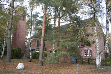
B 6 traffic lights at the Langendamm / Schessinghausen junction into Führser Mühlweg along the barracks to the pharmacy; turn left into Ostlandstraße until shortly after the school, then right into Rossittener Weg, after approx. 50 m turn right again to the SCB Langendamm gymnasium. You can park there. Now walk along the "Königsallee" towards the Schützenhaus, the information board can already be seen.
The Osterberg was a military training area for the German Armed Forces from the Second World War until 1990 and was then lovingly renaturalized by the "Bergheide" citizens' initiative together with the Wense Federal Forestry Office. The routes were signposted on the occasion of the SCB's 60th anniversary celebrations on July 5, 2008.
There are three routes of 2 km, 3 km and 5 km in length on wide, natural paths, some sections are filled with sand. Sometimes all three routes run together. Especially when the heather is in bloom, you have a wonderful view over this natural recreation area from the highest point, the triangulation point (52 m). Several benches at prominent points invite you to linger - let your gaze wander and enjoy the idyll.
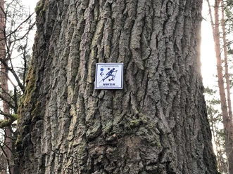
The 5 km route (black) is the most challenging. At first it runs together with the red route, shortly after the 4 m hill it turns right to the "Planet Trail" (project of the secondary school), then runs parallel to the railroad tracks and then on to the lowest point of the route: the Sandkuhle (26 m above sea level). Here you have to overcome a height difference of 9 m to reach the finish after a short further course together with the 3 km route.
Safety instructions:
The Osterberg was a military training area for the German Armed Forces from the Second World War until 1990 and was then lovingly renaturalized by the "Bergheide" citizens' initiative together with the Wense Federal Forestry Office. The routes were signposted on the occasion of the SCB's 60th anniversary celebrations on July 5, 2008.
There are three routes of 2 km, 3 km and 5 km in length on wide, natural paths, some sections are filled with sand. Sometimes all three routes run together. Especially when the heather is in bloom, you have a wonderful view over this natural recreation area from the highest point, the triangulation point (52 m). Several benches at prominent points invite you to linger - let your gaze wander and enjoy the idyll.
The 5 km route (black) is the most challenging. At first it runs together with the red route, shortly after the 4 m hill it turns right to the "Planet Trail" (project of the secondary school), then runs parallel to the railroad tracks and then on to the lowest point of the route: the Sandkuhle (26 m above sea level). Here you have to overcome a height difference of 9 m to reach the finish after a short further course together with the 3 km route.
Safety instructions:
- Throughout the entire tour, please note that the paths are used at your own risk
- No guarantee is given for the usability of the paths
- In the towns/villages, increased attention is generally required
- On the tour, you must expect to encounter danger points, such as bollards, barriers and unsecured crossings

Good to know
Best to visit
suitable
Depends on weather
Author
Mittelweser-Touristik GmbH
Lange Straße 18
31582 Nienburg/Weser
Organization
Mittelweser-Touristik GmbH
License (master data)
Mittelweser-Touristik GmbH

Nearby